Isochrones: working with Mapbox to improve access to immunization services
Geospatial analysis is fundamental to our work at Ona. Whether helping organizations see where they collect data, understanding where to send malaria spray teams, or assessing the impact of a cyclone, we often focus on novel applications of mapping technology for our humanitarian partners.
In our latest effort, we partnered with Mapbox to make isochrones available as a service and help governments manage vaccination campaigns, which is particularly salient during the COVID-19 pandemic. The barriers people face accessing vaccination services are significant; if reaching a vaccination location is a half-day journey, a portion of the population will go without. It is therefore essential to quantify and understand access geographically as countries develop vaccine deployment strategies to reach as many people as possible.
Through microplanning, countries identify what population can be reached via primary health centers and what portion lives in remote areas, where the vaccine needs to be delivered via outreach. To facilitate microplanning, our goal is to calculate access in an accurate and scalable way.
One common approach is to use simple as-the-crow-flies distance, a method called buffers i.e. drawing concentric circles at different distances around the health service point, and identifying the communities that lie within and outside of these areas. While distance buffers are easy to generate and use, they are not a reliable way to measure the actual time it takes to travel to a health facility. They don’t account for natural barriers like hills and rivers, nor the fact that travel along a paved road is much faster than walking through a field.
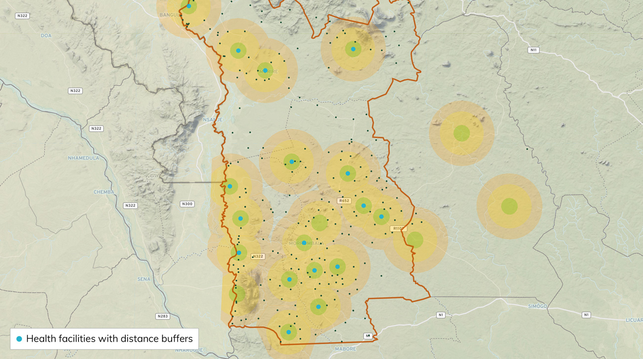 Distance buffers express areas of coverage without accounting for physical barriers
What we need instead is an accurate estimate that measure actual time, since that’s how people make decisions. We want to identify people that live more than 120 minutes from a health facility, the “hard-to-reach” population, so we can target them with a mobile campaign. To calculate travel times, we make use of isochrones, which indicate all of the land area accessible from a location within a certain time threshold. Unlike distance buffers, the calculation of an isochrone uses the travel speed of roads or footpaths while accounting for physical barriers, topology, and other factors.
Isochrones, while incredibly powerful, are not very easy to compute. Generating isochrones requires a routing engine and access to an extensive set of data inputs including road networks, location of physical barriers, and topography. One of the most sophisticated tools we’ve used to calculate travel times is AccessMod, an accessibility modeling tool funded by the World Health Organization. While AccessMod is well packaged, it is designed primarily to run desktop analysis and requires an analyst to bring together all the data needed for the area of interest. Our goal has been to make this type of analysis available as a service within a package that is easy to implement and can be replicated across as many locations as possible. In search of an accurate solution that can scale, we partnered with Mapbox.
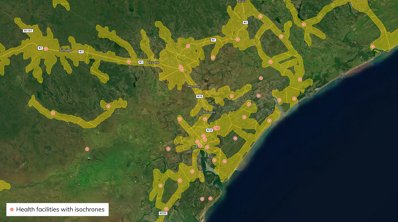 Isochrones map the space that can be traveled via road within a specific time window
Mapbox offers an Isochrone API that quickly generates geometries based on publicly available topographical and infrastructure datasets such as OpenStreetMap (OSM). This approach comes with several advantages which make it effective for our problem. First, it requires only a GPS point for input and no other data preparation. Second, it is lightning fast and so is well suited for batch analysis. Finally, it is based on the most up-to-date available information from OSM and Mapbox traffic, meaning an update to OSM can improve the accuracy of the time estimates in a community. The team at Mapbox granted us special access to extend the max isochrone travel time calculation from 60 to 120 minutes, in line with the public health definition of “hard-to-reach”. We worked together on the model to ensure accuracy in rural settings, where dirt roads and walking paths are prevalent.
We are excited to deploy this technology to work on COVID-19 vaccine access. If you are interested to explore this approach to microplanning, or have ideas of other public health and development challenges, let’s talk.